

 November 13th, 2012
  knowtheflow
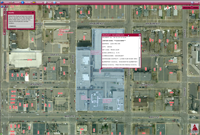
Residents, parents, property owners, businesses, developers, and utilities officials should find the Anoka County Geographic Information System (GIS) website helpful for many uses.
Search for Anoka County parcels by PIN Number or address, with links to detailed property information and recorded plats. Identify parcels, section corners, half-sections and create an aerial map of your property. Use map tools to measure distance and area. This application is useful for residents and developers submitting applications for building permits or development (and redevelopment) plans.
Drinking Water Supply Management Area Map Page
Use the interactive map to determine the location of wellhead protection areas (called Drinking Water Supply Management Areas or DWSMAs) for pubic water supply wells. Pollution from properties within a DWSMA has a higher probability to contaminate the drinking water source for hundreds or thousands of people. Information provided in this application includes the name and contact information for the wellhead protection manager of each DWSMA.
Use the interactive map to find parks, recreation centers, trails and playgrounds near you. See where you can swim, skate, play tennis golf, basketball and baseball. Get photos and detailed information about reacreational facilities anywhere in the county. For more information and resources on getting healthier through physical activity, start with Go Anoka County webpage.
Use this interactive map to find providers close to your home or work. Search for providers within any Anoka County city. And for any provider, click a link to see their listing on the state licensing website. For more information about finding or operating a licensed child care (day care) establishment in contact the Anoka County Child Care Licensing unit at 422-7146.
 Posted in