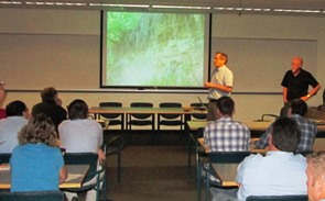
(UPDATE 9/19/2013) The Minnesota Gelogical Survey held a workshop presenting Part-A of the Geologic Atlas of Anoka County. The last part (Part B) is projected to be completed in 2015.
A county geologic atlas provides information necessary for sustainable management of ground water resources, for applications such as monitoring, water allocation, permitting, remediation, and well construction. The Anoka County Geologic Atlas will help to understand aquifer properties and boundaries, as well as the connection of aquifers to the land surface and to surface water resources. It can also provide a broad range of information on geology, mineral resources (including construction materials), and natural history.
The Anoka County Geologic Atlas is being prepared in two parts. Part-A has been prepared by Minnesota Geological Survey (MGS) which includes a water well database and 1:100,000 scale geologic maps showing properties and distribution of sediments and rocks in the subsurface. Part-B will consist of water levels in aquifers, direction of groundwater flow, water chemistry, and sensitivity to pollution. The geologic atlas was initiated by the Conservation District and the Watershed Management Organizations in Anoka County.
The Part A (surficial and bedrock geology) of the Anoka County Geologic Atlas has been completed. Part B (hydrology and sensitivity to pollution) is being prepared. The project is planned to be completed by 2015.
To help understand the importance of our water resources the Minnesota Department of Natural Resources has released new videos on the Mt. Simon Aquifer which is the deepest source of groundwater in Anoka County and the metropolitan region.
For more information contact Jamie Schurbon at the Anoka Conservation District (763-434-2030 x12).


 September 19th, 2013
  knowtheflow
  Posted in