Comments welcomed on the Central Anoka County Reg. Trail Plan

COMMENTS ARE ACCEPTED UNTIL JANUARY 15TH. The proposed Central Anoka County Regional Trail is a 26 mile paved regional trail that traverses the middle of Anoka County connecting Mississippi West Regional Park in Ramsey, MN to Rice Creek Chain of Lakes Park Reserve in Lino Lakes and Centerville, MN. The trail master plan was first adopted by the Anoka County Board of Commissioners in 1999 and then expanded to the Washington County line in 2008. A total of approximately 16 miles of the trail have been constructed to date.

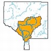
The County has an opportunity to partner with the City of Andover to construct a pedestrian tunnel under CSAH 116 to provide safe passage into Bunker Hills Regional Park. Therefore, to take advantage of this partnership, Anoka County is proposing to amend the Central Anoka County Regional Trail Master Plan to include the tunnel into the regional trail plan. The indicated area shows the location of the trail in the county and the location of the proposed master plan amendment.

Anoka County has an opportunity to partner with the City of Andover to construct a pedestrian tunnel under CSAH 116 to provide safe passage into Bunker Hills Regional Park.

The pedestrian tunnel under CSAH 116 (indicated/circled) will provide safe passage into Bunker Hills Regional Park.

Information can be obtained by visiting www.anokacountyparks.com. Those who have questions or comments may contact the Project Manager: Karen Blaska, Park Planner, Anoka County Parks and Recreation Department, 550 Bunker Lake Blvd. NW, Andover, MN 55304 or via telephone at 763-767-2865 or e-mail at karen.blaska@co.anoka.mn.us. Written comments on the master plan are preferred and may be submitted to the project manager listed above.

For the sake of our lakes, keep your pavement on a low-salt diet

As the snow falls and temperatures drop to freeze roads, driveways, parking lots and sidewalks – most of us will rely on SALT to clear roads and sidewalks. It is estimated that we use more than 350,000 tons of salt on the metro area roads, parking lots and sidewalks annually.

Road salt, containing chloride, enters our surface waters and groundwater after the snow and ice melts. Once in the water, salt becomes a permanent pollutant and causes harms to fish, insects and plants and changing the quality of our lakes, streams, and groundwater. There are many ways to reduce salt use while maintaining safe travel-ways. One is shoveling. The more snow and ice you remove manually, the less salt you will have to use and the more effective it can be. Watch (MPCA YouTube; 3:19) how our lakes and streams are monitored for salt pollution.

(MPCA YouTube; 3:19)

TIPS to reduce salt use:

  • Shovel first.  The more snow and ice you remove, the less salt you will have to use and the more effective it can be. After the ice has been broken up, you can decide whether deicer is even necessary to maintain traction.
  • Apply salt before the storm. Salting before can prevent snow and ice from building up on roads, therefore reducing overall salt use.
  • More salt does not mean more melting. Use less than four pounds of salt per 1,000 square feet (an average parking space is about 150 square feet). One pound of salt is approximately a heaping 12-ounce coffee mug. And be patient: salt takes time to work. Applying more will lead to unnecessary contamination.
  • 15 degrees is too cold for most salt to work. Most salts stop working at this temperature. In frigid conditions, use sand for traction.
  • Sweep up extra salt. If salt or sand is visible on dry pavement, it is no longer doing any work and will be washed away.  The excess can be swept up and reused for the next snow or disposed of in the trash.

The Watershed Approach (Video Series)

Watershed Diagram (MN Pollution Control Agency)

Four-part video series developed by the Minnesota Pollution Control Agency

The Minnesota Pollution Control Agency has developed a four-part series on the “Watershed Approach” a relatively new process for gauging the health of Minnesota’s waters and taking action to protect or restore them. The series includes:

This series is a great tool for introducing citizens and volunteers to local watershed work, for opening public meetings on watershed projects and to sharing with students.


Waterspot on League of Women Voters natural resources conservation

The Natural Resources initiatives of the League of Women Voters – Minnesota promotes policies and actions to maintain an environment beneficial to life through the protection and wise management of natural resources. League activists helped pass the Clean Water Act. Water issues, including groundwater protection, agricultural runoff and the Safe Drinking Water Act energize League members into action at the local, state and national levels.

In Minnesota, the League supports:

  • Sustainable agricultural that provides safe food and preserves natural resources.
  • Measures to reduce air pollution from vehicular and stationary sources.
  • Responsible energy policies and goals.
  • Measures to ensure safe treatment, storage and disposal of all wastes.
  • Comprehensive long-range transportation planning that preserves natural resources.
  • Preservation and management of Minnesota’s water resources through protection, allocation, conservation, pricing and protective watershed basin transfer policies.
  • A water conservation plan emphasizing preservation and efficient use.

The Upper Mississippi River Region Inter-League Organization (ILO),  formed in October 2015, will establish a strategic plan to protect the Upper Mississippi River Region. The ILO incorporates local Leagues of Minnesota, Illinois, Wisconsin and Iowa. This group will conduct community outreach to educate on specific land use, agricultural, industrial, residential effects on the water quality. Partnering with governing officials and other concerned organizations, the goal is to improve and protect the water quality. of this remarkable eco system.

Track the activities and progress of the League of Women Voters ABC (Anoka, Blaine and Coon Rapids) through their Webpage and Facebook.

League of Women Voters (ABC)

Rum River water quality project completed

The Rum River is an important watershed corridor between Mille Lacs Lake and the Mississippi River. Erosion adds more than 250,000 pounds of sediment to the Rum every year in a length of the river recently acquired by Anoka County and designated the Cedar Creek Conservation Area. This year, Anoka County Parks Department and the Anoka Conservation District with the support of the Minnesota Department of Natural Resources and the Lessard-Sams Outdoor Heritage Fund completed a River Bank Stabilization Project that will reduce sediment entering the Rum River by 286,875 pounds per year.

KTF(image)CCCA-RibbonCutting(580x1103)

“The Rum River is a crucial corridor for water quality, habitat, recreation, and the fishing we in Minnesota know and love, both upstream and downstream,” said Anoka County Commissioner Matt Look, an avid outdoorsman. “Shoring up this section of river bank and slowing down the river’s trajectory at times when it’s roaring with rainfall will help maintain and restore the water quality for generations.” 

Other projects in the Rum River Watershed include:

Green Lights Recycling celebrates America Recycles Day

Green Lights Recycling (GLR) has announced a new recycling program set to begin in conjunction with America Recycled Day on November 15, 2015. GLR will offer FREE RECYCLING for all types of cell phones, iPads and electronic tablets. The Green Lights drop-off location is at 10040 Davenport Street NE, Blaine MN 55449. Hours are Monday through Friday from 7:30 a.m. to 4:00 p.m.

Green Lights Phones/Pads Recycling

Since September of 1995, Green Lights Recycling, Inc. has provided recycling services that have expanded. GLR began by recycling fluorescent lamps and High Intensity Discharge (HID) Lamps.  GLR recycles older PCB Ballasts and newer Electronic Ballasts.  GLR is based in Blaine where the recycling process is done converting otherwise hazardous waste into re-usable commodity grade goods.  Materials such as glass, metal end caps, brass tips, phosphorous powder and even elemental mercury are reclaimed.

Veterans Day Programs

Veterans Day - ThankYou

World War I – known as “The Great War” – ended when an armistice, or temporary cessation of hostilities, between the Allied nations and Germany went into effect on the eleventh hour of the eleventh day of the eleventh month. For that reason, November 11, 1918, is regarded as the end of “the war to end all wars.” In 1919, President Wilson proclaimed November 11 as the first Armistice Day.

Armistice Day was primarily a day set aside to honor veterans of World War I, but in 1954, after World War II had required the greatest mobilization of soldiers, sailors, Marines and airmen, Congress removed the word “Armistice” from the law and inserted in its place the word “Veterans.” With the approval of this legislation, November 11th became a day to honor American veterans of all wars.

The observance of Veterans Day is a celebration to honor America’s veterans for their patriotism, love of country, and willingness to serve and sacrifice for the common good. Many celebrations and observance of Veterans Day are taking place in Anoka County including:

  • Anoka High School. Veterans are invited to the Veterans Day Assembly on November 11, 2015 from 9:00am to 10:00am. More information.
  • Andover High School. Veterans are invited to the Veterans Day Assembly on November 11, 2015 from 9:00am to 9:45am.
  • Blaine High School. Veterans are invited to attend the Veterans Day Assembly on November 11, 2015 from 10:00am to 11:00am. More information.
  • Fridley Community/Senior Center. Veterans are invited to the Veterans Day Celebration on November 11, 2015 from 11:00am to 1:30pm. More information.
  • Read more about Veterans Day events and discounts at http://www.anokacounty.us/2218

VIDEOS

BOOKS  There are a lot of books about war. But if you want to read about it from someone who was actually there, here’s a selection of books by Minnesota veterans and authors (from the TwinCitiesPioneerPress).

Coon Creek Watershed District is planning to protect water quality

The Coon Creek Watershed District (CCWD) has released its draft Total Maximum Daily Load (TMDL) and Watershed Restoration and Protection Strategy (WRAPS) reports for public review and comment through Thursday, January 28. 2015. For more information see the Minnesota Pollution Control Agency (MPCA) public notice. The reports are posted on the CCWD website.

Required by the federal Clean Water Act, a TMDL is a scientific study, conducted on waters assessed to be impaired, that calculates the maximum amount of a pollutant that a waterbody can receive and still meet acceptable water quality standards for that pollutant. It is a process that identifies all the sources of the pollutant causing an impairment and quantifies necessary reductions among them.

The Watershed Restoration and Protection Strategies (WRAPS) report is required by the Minnesota Clean Water Legacy Act and uses TMDL and other information to develop strategies for addressing point and nonpoint pollution sources. The objective is to restore impaired waters and protect unimpaired waters from degradation. This report is a collaboration among the MPCA, other state agencies, local government partners, and other stakeholders.

Comments on the reports should be submitted in writing by Jan. 28, 2016, to Rachel Olmanson, MPCA, 520 Lafayette Road N., Saint Paul, MN 55155-4194, or sent by email to rachel.olmanson@state.mn.us. Olmanson is available to answer questions at 651-757-2473.

Coon Rapids fighting pollution with rain gardens

In the City of Coon Rapids, 18 curb-cut rain gardens will be installed this fall. The rain gardens will be evenly distributed between two neighborhoods that contribute runoff (water drainage from roofs, driveways, roads, sidewalks, etc) into Woodcrest Creek and Sand Creek that flow into the Mississippi River. The neighborhoods were identified as the most effective locations for rain gardens. The 18 residents (17 homes and one City of Coon Rapids property) have agreed to maintain the rain gardens for a 10-year period.

Stormwater runoff from the neighborhoods into gutter and storm-drains discharge to the creeks untreated. The rain gardens will reduce volume and pollutant loading by allowing the runoff to soak into the ground. Funding is provided by the Coon Creek Watershed District and ACD provided property targeting, promotion, design, and construction oversight.

Coon Rapids Rain Gardens Video

View the VIDEO (YouTube, CTN Coon Rapids; 2:26).

For more information about rain gardens go to the Anoka Conservation District website or call 763-434-2030.

4th graders: get your free pass to national parks

Parents, teachers, families, and children, explore together the millions of acres of national parks, historic structures, cultural artifacts, ancient forests, snow-capped mountains, and clear blue lakes. 4th graders and their families (or classrooms) get free access to hundreds of parks, lands and waters for the entire school year. To begin, access an Every Kid in a Park pass. The pass will give you free access to national parks, national forests, national wildlife refuges, and more!

Every Kids Park Pass

Fourth-grade teachers can also download activities and print Free National Park passes for each of your students. The passes are good through August 31, 2016. Get yours today and plan a trip! For information, please contact via email everykidinapark@ios.doi.gov or visit https://www.everykidinapark.gov/.

Mississippi National River and Recreation Area extends 72 miles along the Mississippi River. Part of the park extends along the Anoka County border in Ramsey, Anoka, Coon Rapids and Fridley where there’s a dam and water treatment works draw water for people. You can learn about river ecosystems at several of the recreation area’s visitor centers, including an interpretive center in Minneapolis. A heron rookery lies just downstream. Across the river in St. Paul, the Mississippi River Visitor Center helps you explore the park and plan activities — from river walks and canoeing to biking and birding. In the winter, visitors often don snowshoes or cross-country skis to traverse river trails. Numerous points of interest lie just north and south of the Minneapolis area, including Hastings River Flats where a dam provides a perfect ecosystem for the eagles you can observe there.

Did you know: At Lake Itasca, where the Mississippi River begins, the river elevation is 1,475 feet above sea level. And is 841 feet at the Coon Rapids Dam. It drops to sea level at the Gulf of Mexico. More than half of that drop occurs within the state of Minnesota.

Voyageurs National Park – A little more than a half-day drive from the Twin Cities, Voyageurs National Park lies due north near the Canadian border. Voyageur is a French word meaning “traveler,” and pertains especially to those involved with the North American fur trade in the 1700s. Hardy men paddled large canoes on connecting lakes and rivers on a route stretching from northwest Canada to Montreal and through what is now the park. Water covers almost 40 percent of the park. The Rainy Lake Visitor Center features a film and exhibits detailing the area’s history and voyageur routes. Many visitors rent houseboats and explore wilderness areas punctuated by many islands. Hikers may choose from nine trails, from short loop walks to back country excursions. On your hike, you may see black bear and white-tailed deer, and in winter may spot fox and otter on frozen ponds. Visitors with additional time can visit Grand Portage National Monument, a park that marks the spot where voyageurs and Native Americans made a “grand portage” between Lake Superior and inland waterways. The park is northwest of Duluth on Lake Superior.

Powered by WordPress