The Anoka Conservation District and the seven (7) watershed management organizations are a terrific source of water information and protection activities in Anoka County. The Anoka Conservation District (ACD) is a non-regulatory county level subdivision of state government. ACD provides technical and financial assistance to private landowners to manage natural resources in a way that conserves […]
Archive for the ‘City of Columbia Heights’ Category

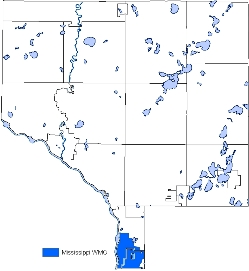
Drinking water protection map now includes the Mississippi River
 January 10th, 2014
  knowtheflow
 UPDATE (1/13/2014) A chemical spill that polluted a Charleston, West Virginia river last week is an example of the importance in managing potential pollutants that can contaminate a drinking water supply. Minneapolis and St. Paul regional water systems get their water from the Mississippi River. For information on preventing pollution of the Mississippi River and protecting […]
Comments invited on the Minnesota Strategic Plan for Groundwater Management
 October 30th, 2013
  knowtheflow
 (UPDATE 11/5/2013) Today, the U.S. Environmental Protection Agency has released a report on the Importance of Water to the U.S. Economy (PDF, 37 pp, 2MB). The report highlights water’s importance to our national economic welfare, and summarizes information necessary to understand and manage water resources. The Minnesota Department of Natural Resources (DNR) has released their Draft Groundwater Strategic Plan (GWSP) to […]
Mississippi River nutrient reduction strategy
 October 18th, 2013
  knowtheflow
 Water is among Anoka County’s most valued natural resource. Anoka County is part of the Mississippi River watershed. In the Land of 10,000 Lakes, Minnesota’s tourism and economy depend on healthy waters that provide recreational opportunities, safe drinking water, productive agriculture, healthy fish and wildlife habitat. The goal for Minnesota water is to be fishable and […]

Drinking water quality reports are available
 July 1st, 2013
  knowtheflow
 Drinking water is generally in good shape at Anoka County’s community water supply systems, according to the Minnesota Department of Health’s (MDH) Drinking Water Annual Report 2012. Highlighted in the report is completion of the first phase of a new water and stand-alone wastewater system in East Bethel. “Water is the key to development” said […]

Columbia Heights High is competing in the Metro Area Envirothon
 April 1st, 2013
  knowtheflow
 The 2013 Metro Area Envirothon is a a problem solving natural resources competition for both Junior High (grades 6-8) and Senior High (grades 9-12) students. Students are tested on their knowledge of Minnesota’s natural resources – Aquatics, Forestry, Soils, Wildlife, and a current environmental issue that changes from year to year. This year the Envirothon […]

Plan ahead to celebrate Arbor Day
 March 24th, 2013
  knowtheflow
 Governor Dayton has proclaimed April 26, 2013 as Arbor Day and May 2013 as Arbor Month. Each year, on the last Friday of April, and throughout the month of May, Minnesotans recognize the value of trees, forests and the natural resources they represent. Trees brighten the environment by moderating climate, improving air and water quality, conserving water […]

Welcome Mississippi Watershed Management Organization
 February 1st, 2013
  knowtheflow
 The Mississippi Watershed Management Organization (MWMO) now extends into Anoka County protecting and managing surface water in portions of Columbia Heights, Fridley and Hilltop that drains to the Mississippi River. MWMO Mission Statement is to lead and foster stewardship of the watershed with actions that promote civic ownership and responsibility and through measures that achieve diverse […]

Celebrating 40 years of the Clean Water Act in Anoka County
 October 15th, 2012
  knowtheflow
 Forty years ago, public concern about untreated sewage, industrial and toxic discharges, and contaminated stormwater runoff led to passage of a principal law to protect the nation’s waters – the Clean Water Act (CWA). Based on state and local efforts, CWA sets a national goal “to restore and maintain the chemical, physical, and biological integrity of […]

FEMA is updating Flood Insurance Rate Maps
 October 5th, 2012
  knowtheflow
 The Federal Emergency Management Agency is currently updating Flood Insurance Rate Maps (FIRM) in Anoka County. Flood risk can, and does, change over time for many reasons including new development and environmental changes, to name a few. As a result FEMA is updating flood hazard maps across the country. These new flood maps show flood […]


 Posted in